Every guide to West Lake in Hangzhou tells you the lake is free and that you should "allow half a day". Both are true and both are useless. I wanted to know what actually happens if you put one foot in front of the other and refuse to take a bus: how long the loop really is, where the pavement gives out, and at what hour the place stops belonging to you. So on a clear October morning I started at Broken Bridge at 06:42 and kept going clockwise until I was back at the same railing. This is the log, including the bits that went wrong.
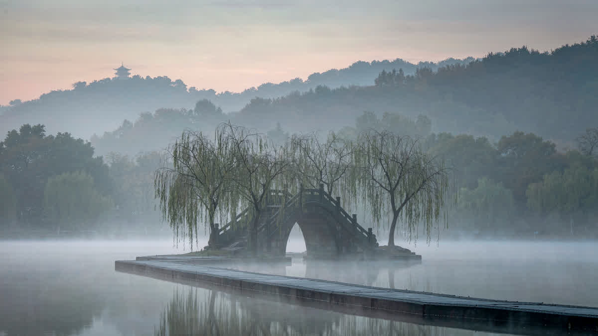
Where I started: 6:42 a.m. on the north shore
The plan was simple, and I had made it the night before over a map I could barely read: keep the water on my left, never cross to the far side, and only pay for things that are actually walled off. Hangzhou's lake covers about 6.39 km², which sounds small until you remember that the shoreline is a wiggle, not a circle — the full loop is roughly 15 km once you add the causeways that cut through it.
I also had a backup I never used: Hangzhou's red public bikes (小红车), free for the first hour. Every rental dock I passed between 07:00 and 17:00 was either empty or full, never in between, and by the time I understood why — everyone rides in one direction at one hour — I was already committed to walking.
06:42 to 09:10: the north shore before the buses
At 06:42 Broken Bridge (断桥) belonged to six people: four photographers with tripods, one man doing slow tai chi shapes facing the water, and a woman sweeping the paving with a bamboo broom twice as tall as she was. The light came in flat and grey, which is the flattering light for this lake. Bai Causeway (白堤) is only 1 km long and I walked it in 14 minutes, stopping twice, and it was the easiest stretch of the entire day: flat, wide, willows on both sides, no vehicles at all.
By 08:15 the first tour flags appeared at Gushan island. By 08:50 the path had the specific density where you stop looking at the lake and start managing your shoulders around other people. I learned the day's first lesson early: on this lake, the crowd is not a mood, it is a schedule. Everything before nine o'clock is a different country.
09:10 to 12:30: Su Causeway, 2.8 km of straight line
Su Causeway (苏堤) is the spine of the lake and the reason the walk is worth doing at all: 2.8 km, six named bridges, and water on both sides for the entire distance. The bridges, east to west, are 映波, 锁澜, 望山, 压堤, 东浦 and 跨虹. I wrote them down at the fourth one because I kept forgetting the order, and a man selling bottled water asked what I was doing and told me I had the second and third swapped. He was right.
This is the section where the walking pays off. A tour bus can stop at the causeway's north end but cannot follow you down it, so the middle third was quiet even at 11:00. I ate a 片儿川 — Hangzhou's bamboo-shoot-and-pork noodle — at a small shop just off the south end for ¥38, and it remains the best-value thing I bought all day.
12:30 to 15:00: the boat, the island, the pagoda queue
From Viewing Fish at Flower Harbour (花港观鱼) the shore gets busier and the pavement gets worse, and this is where I broke my own rule. I paid ¥55 for a boat that lands on 三潭印月, the little island with the three stone lamps printed on the back of every ¥1 note in circulation. The island itself is small enough to circle in 20 minutes; the queue for the return boat was 35 minutes. Then Leifeng Pagoda: ¥40, rebuilt in 2002 over the ruins of the original, with an escalator up the hillside that I resented and then used.
Worth it? The view from the top is the only place on the whole walk where you can see the lake as a shape rather than as a series of bays, and that reframed everything I had walked through for six hours. But it cost me the two quietest hours of the afternoon.
15:00 to 17:55: the western hills and the last 3 km
The west side is a different proposition: shaded, steep in places, and lined with the things most day-trippers never reach. I passed Yuewang Temple without going in, walked the 曲院风荷 beer-and-lotus garden at the hour when the lotus was already over, and then made my last real decision of the day — turn inland for Lingyin Temple or finish the loop. I turned inland.
Lingyin is ticketed twice: ¥45 for the Feilai Peak grottoes and ¥30 for the temple itself, bought at two different windows about 200 m apart. The grottoes are the better half — small Buddhist figures cut into a limestone cliff, some of them from the tenth century. By the time I got back to the lake it was 17:20, my left heel had a blister the size of a coin, and the last 3 km along Beishan Road were walked entirely on stubbornness. I reached Broken Bridge at 17:55.
The numbers, if you are planning your own loop
- Distance: 15.4 km by my phone, including the Lingyin detour — the pure lakeshore loop is closer to 13 km.
- Time: 06:42 to 17:55, with 11 hours 13 minutes of it on foot and the rest queueing, eating or sitting.
- Steps: 23,800. I had packed one pair of shoes and they were the wrong pair.
- Money: ¥218 — pagoda ¥40, boat ¥55, Feilai Peak ¥45, Lingyin ¥30, noodles ¥38, two bottles of water ¥8, one bus at the end ¥2.
- Free: the entire lakeshore, both causeways, and every park along the way. West Lake's ring of parks dropped its ticket in 2002; only the walled sites charge.
What I would change on a second attempt
Three things. I would start at 06:00 instead of 06:42 — that extra 40 minutes is the difference between an empty Bai Causeway and a populated one. I would skip the boat entirely and spend that hour walking the western hills slowly, because the island is a postcard and the hills are a place. And I would do the Lingyin detour in the morning by bus, then walk back down to the lake, so the flat boring final 3 km becomes a downhill 3 km at the end of the day instead of a punishment.
The one thing I would not change is doing it on foot at all. The lake is built at walking scale — every view was composed by someone who expected you to arrive slowly, notice a bridge, and then notice the next one. At 40 km/h you get the postcard. At 3 km/h you get the thing itself.